
This is an old revision of the document!
Table of Contents
Export
About the export
The new export function allows you to export any map section in various sizes as PDF or image. Based on the feedback from many users, the export has been improved. You find the export here.
How to use the export
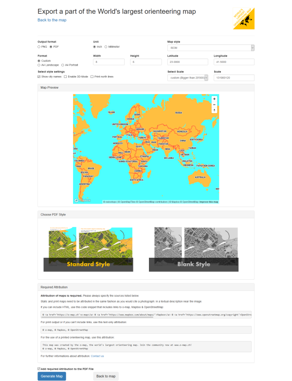 Screenshot from the o-map export.
Correct attribution
Attribution of maps is required. Please always specify the sources listed below.
Static and print maps need to be attributed in the same fashion as you would cite a photograph: in a textual description near the image.
If you can include HTML, use this code snippet that includes links to o-map, Mapbox & OpenStreetMap:
© <a href='https://o-map.ch'>o-map</a> © <a href='https://www.swisstopo.admin.ch/de/home.html'>Swisstopo</a> © <a href='https://www.mapbox.com/about/maps/'>Mapbox</a> © <a href='https://www.openstreetmap.org/copyright'>OpenStreetMap</a> <strong><a href='https://www.mapbox.com/map-feedback/' target='_blank'>Improve this map</a></strong>
For print output or if you can’t include links, use this text-only attribution:
© o-map, © Swisstopo, © Mapbox, © OpenStreetMap
For the use of a printed orienteering map, use this attribution:
This map was created by the o-map, the world's largest orienteering map. Join the community now at www.o-map.ch! © o-map, © Swisstopo, © Mapbox, © OpenStreetMap
If the file type is PDF, you have the possibilty to add the attribution automatically.
For further informations about attribution: Contact us